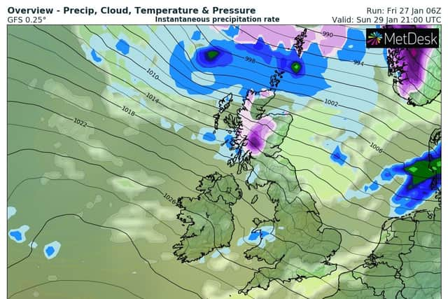
Risk of snowfall across UK as cold snap continues - see WXCharts weather map for likelihood of snow near you
and live on Freeview channel 276
Many thought they’d weathered the winter storm but a cold snap could well continue into next week with some areas of the UK experiencing a 90% chance of snow fall.
Uncertainty surrounding the weather is a staple of British culture and it turns out the experts aren’t sure when this cold snap will end either. This week, the UK Health Security Agency extended the current level 3 amber weather alert until midday on Saturday (January 28).
Advertisement
Hide AdAdvertisement
Hide AdJason Kelly, Chief Meteorologist at the Met Office, said: "Cold, icy and sometimes snowy conditions are in the forecast this week with the UK seeing more of a north-westerly regime, with temperatures well below average for the time of year.”
However, weather maps from WXCharts now show the cold snap could encroach upon next week too with areas in Scotland set to see a 90% chance of falling snow. Scottish Highlands could be the first to see snow on Saturday with a 80% probability, while areas in the North East and North Wales are shown to have a 10% chance of wintry showers.
On Sunday (January 29), it’s predicted Scotland will have a significant chance of snowfall with dark orange and red areas highlighted on the map. However by Monday (January 30), Scotland’s 70% to 90% chance of snow will fall to around 40%.
By Tuesday (January 31), the map predicts the North of England has a 30% to 40% chance of snowfall while areas in Wales could see a slight chance of showers at 10% to 20%.
Advertisement
Hide AdAdvertisement
Hide AdAccording to the Met Office’s long range forecast, wintry themes could lessen as we head into February as the North is set to see blustery showers and sunny spells. The Met Office said: “Initially mostly dry in the south with some sunshine, but likely becoming cloudier with some patchy rain later. Into the rest of the period, the main theme is of high pressure centred to the south, with low pressure systems passing to the north.


“However, the south is also likely to see some rain at times. In any colder interludes between frontal systems, we will likely see a mixture of sunshine and showers, perhaps wintry in the northeast. Temperatures generally varying between mild and cool, with a frost risk remaining.”
